'트레킹'에 해당되는 글 4건

  1. 2013.06.28 [+100] Two Torres del Paine by ATARDECER
  2. 2013.05.08 Very very lucky by ATARDECER
  3. 2013.05.05 Inca Trail Overview by ATARDECER
  4. 2013.04.29 Which Airline? by ATARDECER

+100번째 글

in Bing on June 25, 2013. 

2013년 6월 25일자 검색엔진 Bing 첫화면

in My Memories in March, 2012.

그림 같은 설산, 빙하가 녹아내린 에메랄드 호수, 예쁜 숲길, 시원한 파타고니아의 바람, 처음 봤던 유빙의 경이로움, 무거운 배낭, 빗속에서의 걸음, 고된 캠핑, 총 거리 56km... 마지막날에 처음 시작지점으로 돌아가는 보트위에서 어찌 그리도 화창하게 저멀리 내가 걸었던 곳을 보여주는지. 드라마가 따로 없다. 잊을 수 없는 3박 4일간의 W트레킹의 추억, 토레스 델 파이네 국립공원 - by 글솜씨 없는

Torres del Paine National Park, South America's most stunning national park in Chilean Patagonia and the 5th most beautiful place in the world by the National Geographic.

from the boat on the Lago Pehoe lake on the last day of 4-day W trek, Parque Nacional Torres del Paine, Puerto Natales, Patagonia Chile around March 5, 2012.


크게 보기

Posted by ATARDECER
,

Very very lucky

Viaje/Patagonia 2013. 5. 8. 00:43

Monte Fitz Roy in Patagonia

looking up the Monte Fitz Roy from Laguna de Los Tres

정말 구름한점 없었던 베리베리 럭키! 피츠로이

Patagonia's another picturesque nature, Mt. Fitz Roy. It is also well-known for its sudden weather changes. But there was Not a cloud in the sky. Cloudless! Nothing in the sky. Probably I think I was a luckiest person of all to hike Mt. Fitz Roy. It was a very, very lucky day.

at Laguna de Los Tres of Monte Fitz Roy next to El Chalten in Argentina Patagonia around March 9, 2012.


크게 보기

Posted by ATARDECER
,

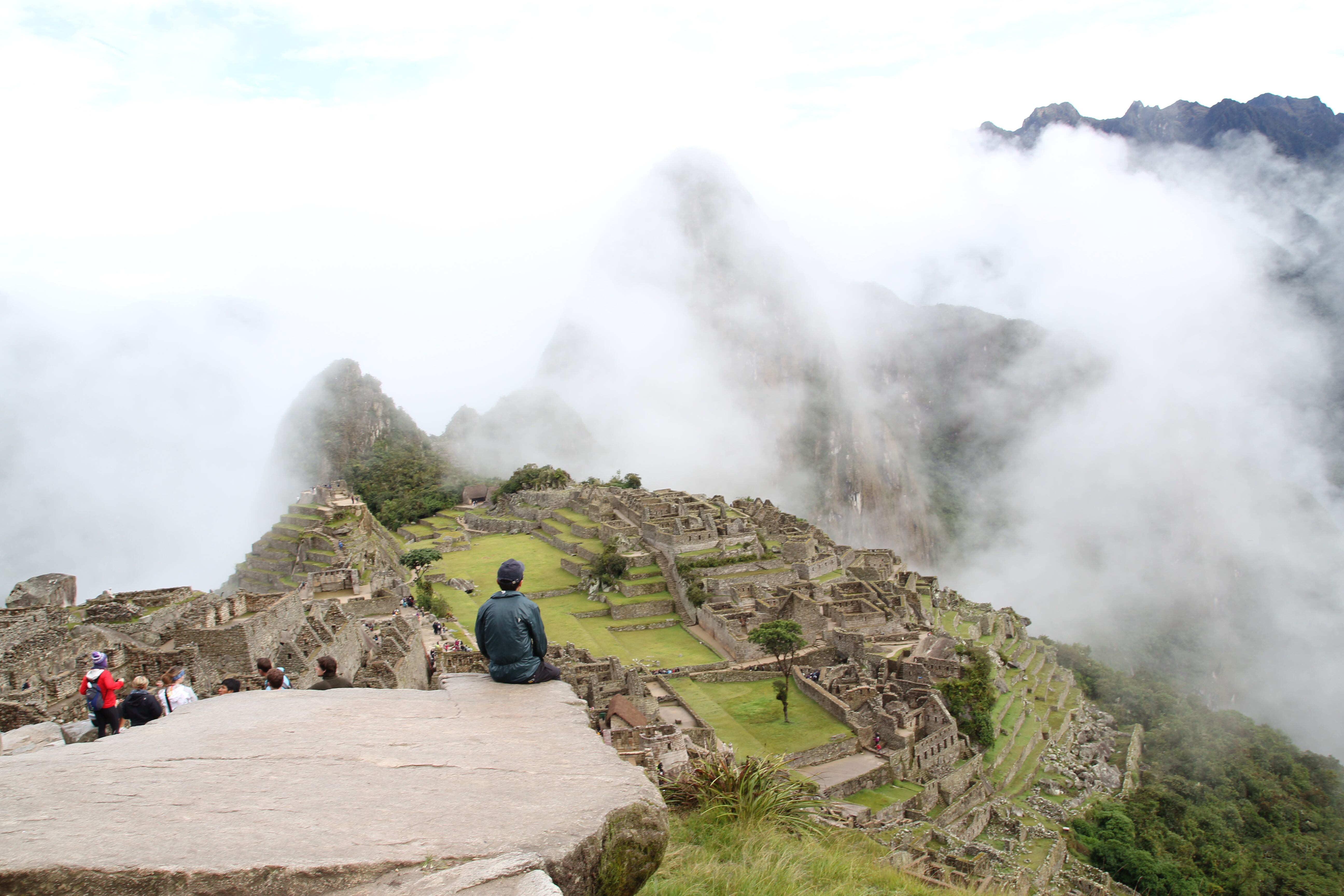
Inca Trail Overview

Viaje/Peru 2013. 5. 5. 23:46

The Way To Machu Picchu, Classic Inca Trail 4 day (Camino Inca)

View larger Google Map

Map from www.llamapath.com

마추픽추로 가는 길, 잉카트레일

일시 : 2012년 1월 25일 ~ 2012년 1월 28일, 3박 4일

루트 : 출발포인트(쿠스코로 부터 82 Km 지점) - 마추픽추

트레킹 총 길이 : 45 Km

트레킹 중 최고높이 : 해발 4,217m

인원 : 총 9 명 (여행객2, 가이드1, 포터6 (셰프1 포함))

에이전시 : 야마패스 (라마패스)


Itinerary : January 25, 2012 ~ January 28, 2012

Duration : 4 days / 3 nights

Departure site : 82 Km point far from Cuzco  (Elevation 2,720m)

Destination : Machu Picchu (Elevation 2,400m, UNESCO World Heritage Site)

Route : Official Inca trail course

Total distance : 45 km

Members : 2 travelers, 1 guide and 6 porters included chef

Agency : Llama Path, Cuzco (Recommended by Lonely Planet)

Posted by ATARDECER
,

Which Airline?

Viaje/Patagonia 2013. 4. 29. 00:11

It's NOT fake. 포토샵 아닙

LAN 항공 lan.com

Aerolineas 아르헨티나 항공 aerolineas.com.ar

GOL 항공 voegol.com

TAM 항공 tam.com.br

TACA 항공 taca.com

Avianca 아비앙카 항공 avianca.com

Sky Airline 스카이에어라인 (칠레 저가) skyairline.cl

LADE 라데 항공 (아르헨티나 공군) lade.com.ar

Pluna 플루나 항공 (우루과이) flypluna.com

Star Peru 스타페루 (페루 저가) starperu.com


Airplane shaped cloud? 

Cloud shaped airplane?

or Whale?

Clearly, it's NOT fake. near camp Italiano on the 2nd day of Torres del Paine 4-day "W" Trekking, Puerto Natales, Patagonia Chile around March 3, 2012.

Posted by ATARDECER
,